Wednesday, May 30, 2007
@ 9:04 AM
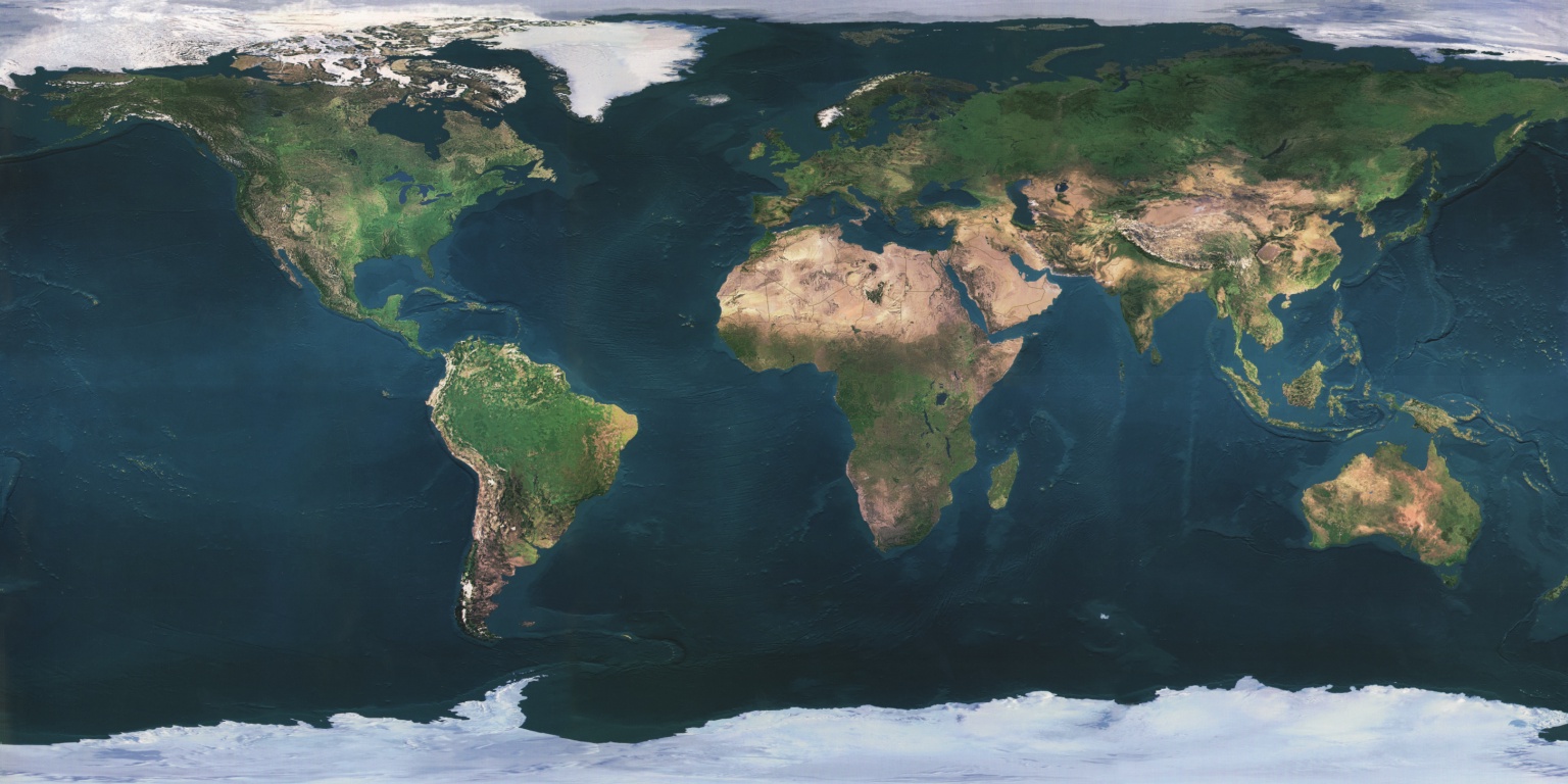 If you want to know more about active volcanoes in the world visit:
http://www.geo.mtu.edu/volcanoes/world.html
Wednesday, May 16, 2007
TYPE OF ROCKS @ 8:05 PM
THERE ARE THREE BASIC GROUPS OF ROCKS:TO KNOW THESE TYPES IN DETAIL,
TO KNOW THEIR EXAMPLES,
TO EVEN KNOW THE "ROCK CYCLE",
VISIT http://www.promotega.org/ksu00006/types.htm
Sunday, May 6, 2007
Exam Tip 4 and final tip @ 6:58 AM
I anm quite tired of you all asking me what chapter to study, It should have been obvious from the chapters I covered, chapter 1 to 13 excluding 7. Focus less on chapter 1, it is not the most important. All classes please take note to collect you test papers and files back from the pigeon hole.
Anyway, let me continue with the rest of the tips for the following chapters, it will be very straightfoward.
Chapter 8:
Know your landforms, like what is a valley, plateau and plain. The difference between hill and moutain.
Know the 3 types of benefits landform can bring about. And how mountains can be a natural barrier and the dangers living on a mountain.
Chapter 9:
The 3 layers of the Earth: Crust, mantle and core.
Understand the crustal movement and what is convection current in the mantle and what it does to the crustal plates.
What is folding process and how fold mountains are created.
What is vulcanicity and volcanic eruption.
Parts of the volcano: magma chamber, pipe, vent, crater. Remember cone is not part of a volcano, it is the volcano.
The 3 types of volcano: active, dormant and extinct.
Chapter 10:
The benefits of living next to a volcano: fertile soil, mining minerals like gold , getting geothermal energy, tourism, cultural and traditional icons and lastly jobs and improve economy (state how they produce jobs and improve the economy)
The dangers: Vulcanic bombs, poisonous ashclouds and lava flow. You know the story behind it all.
Chapter 11:
The difference between weathering (breaking of rocks into smaller parts in situ) and erosion (wearing of rock surface and eroded parts are carried away)
3 types of mechanical weathering: Extreme temperature change (indicate exfoliation), freeze-thaw action and weathering by plants.
Chemical weathering by acid rain, how rainwater and carbon dioxide in the air mixes to form carbonic acid.
Erosion by wind, water and wave. (they all work the same way, all carry sediments like sand and abrade the surface of the rock)
Chapter 12:
Follow my notes. (remember very clearly how each of the 3 rock's crystals are sized, fine, mid and coarse)
Know the uses of granite.
Be able to recognise the 3 types of rocks.
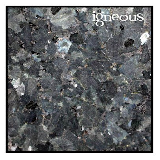
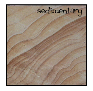
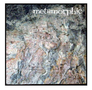
Here are some pictures from UCDavis, University of California to help see better.
Chapter 13:
This is very straightfoward, you should be able to ace this.
Know the earth water distribution in percentage and why it is important to conserve water.
The water cycle: what happens at percipitation, transpiration, condensation, surface runoff and groundwater flow.
Each drainage basin is seperated by a watershed
Parts of the river:
Upper course: (in descending order)
River source (part of the drainage basin)
Tributaries(part of the drainage basin)
Waterfall (find out how they are formed, remember the hard rock comes before the soft rock)
valley
Middle course:
meander (can also be found in the middle-lower course too)
Lower course:
Floodplain
Delta (river mouth, formed by deposition of sediments)
Note that as the river flows down from the mountain, the water will flow slower as the gradient of the land become gentler towards the sea and there is less gravity pull on the water.
Tuesday, May 1, 2007
Exam Tip 3 @ 9:30 AM
For the next 3 chapters, chapters 4-6, you have to take note of the following:Chapter 4:
Know the purpose and a general idea of what each map is.
Know your latitude (horizontal lines, running from 90N to 90S) and longitude (vertical lines, running from 180E to 180w)
For express students, you also need to know what is the international dateline is and how to read the different time zone. A simple method to rememeber is when the question ask you what time is country X is when Country Y is 9am.
1. count the difference in the number of hours between each country by looking at the timechart below (use your textbok page 34 for reference).
2. Minus the hours from 9am if the country X is to the left of country Y and add the hours to 9am if country X is right to country Y.
Chap 5:
Mapwork, something I have repeated countless times.
1. Know the parts of the maps like in page36 and 37 of your textbook.
2. Know how to use the scale, remember that the scale is always in cm, unless otherwise stated and convert the final value to Km.
3. 4 and 6 grid reference, read the easting value (values at the bottom part of the map running from left to right), then the northing value (values at the left side of the map running from bottom to top). 6 grid reference must always be taken with estimation the 3rd and 6th values can only be from 0 to 9. If the 3rd and 6th values is 0, then point will cut across the gridline.
4. Compass direction, if the question ask you to find the compass direction of A from B. READ FROM B!!! THAT MEANS THE POINT OF REFERENCE IS B, NOT A!!!!
5. Bearings, check my previous post.
6. Cross section of landforms, here are a few things for you all to take note:
a. Draw your cross section line first.
b. Draw your contour lines and add the contour values into the cross section box. Remember the bottom part of the box is '0' metres.
c. Draw straight lines down from each contour line to the the respective contour line in the contour box with a ruler.
d. Use freehand and join the points where the lines cross each other and the shape must start from the bottom and the highest point must be slightly higher than the highest contour line.
Chap 6:
There are 3 types of photograpghs: Landscape, aerial and satellite and there are mainly 2 types of human settlements, urban and rural.
Be able to recognise what is human features and physical features. The more buildings there are, the more urban it will be is a good rule of thumb.
Landscape photographs can be splitted in foreground, midground and background. Be able to describe each part with at least one detail. It is unlikely that you will find one with nothing to describe.
That is all for now.